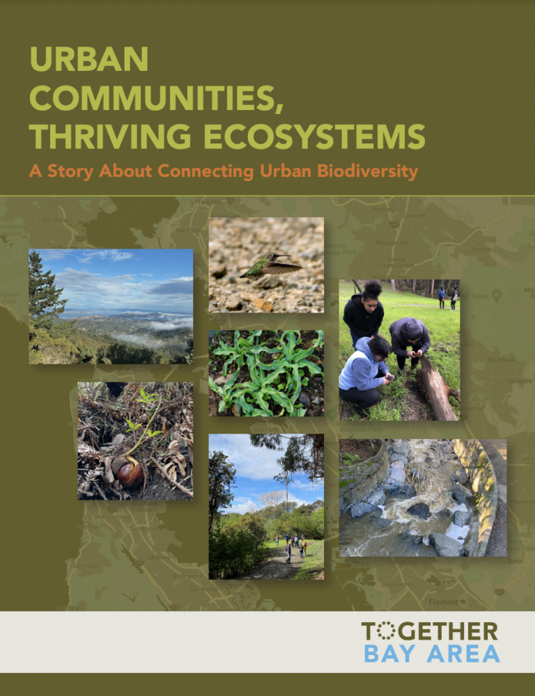
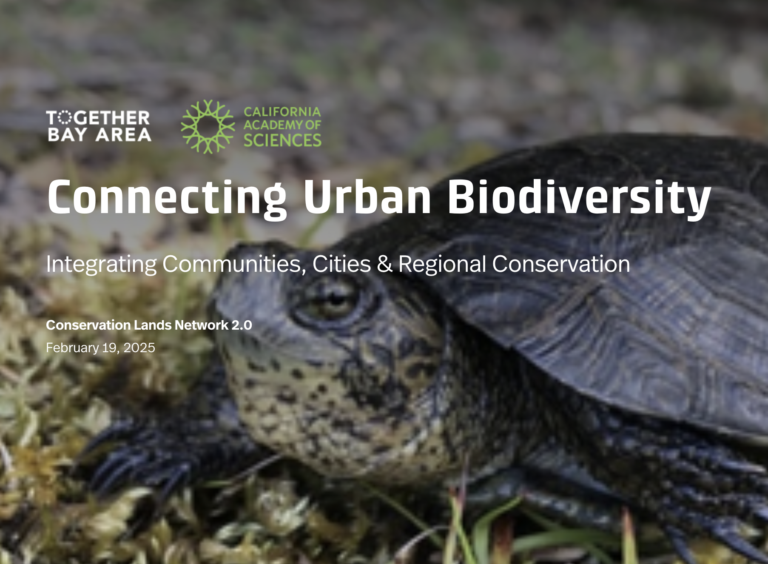
Connecting Urban Biodiversity
Between 2021–2024, the Connecting Urban Biodiversity project explored how we can better integrate urban areas into regional conservation planning and action. The project demonstrates how people living in urban areas, particularly in underserved communities, can collect data in their own neighborhoods that informs conservation science and modeling. Such information, in turn, can feed into decision-making processes at municipalities and public agencies responsible for the state and condition of urban greenspaces and urban forests. By doing so, we can create a positive cycle of community engagement, science, and on-the-ground action that benefits both people and the biodiversity of nature in our urban landscapes.
This project was a partnership between TOGETHER Bay Area and the California Academy of Sciences, with participation and contributions from YES Nature to Neighborhoods, Friends of Sausal Creek, and Salted Roots.
Learn more!
Watch, read, click, and share!
Read the Report
Explore the Story Map
Lessons we learned
1. Collaboration and Local Expertise are Essential
Collaboration lies at the heart of effective conservation, especially in urban settings. Working with local communities and community-based organizations is not just beneficial — it is critical. Local residents hold valuable expertise about their environments, including knowledge of biodiversity, land ownership, and local politics. Building relationships takes time, but it is a necessary investment. CBOs serve as trusted connectors to their communities, and their involvement ensures that conservation efforts address local priorities, needs, and concerns. This project highlighted the importance of engaging with local knowledge to address systemic environmental injustices and demonstrated that regional conservation efforts must be grounded in place-based approaches. While we leveraged years of connections through TOGETHER Bay Area and the California Academy of Sciences, we also learned that gaps remain — particularly in areas like Solano County — underscoring the need for continued outreach and relationship-building over time.
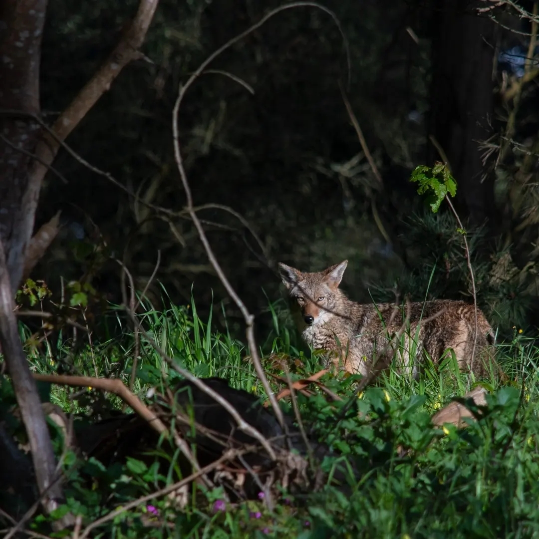
2. Nature Thrives in Cities — Recognize the Role of Urban Biodiversity
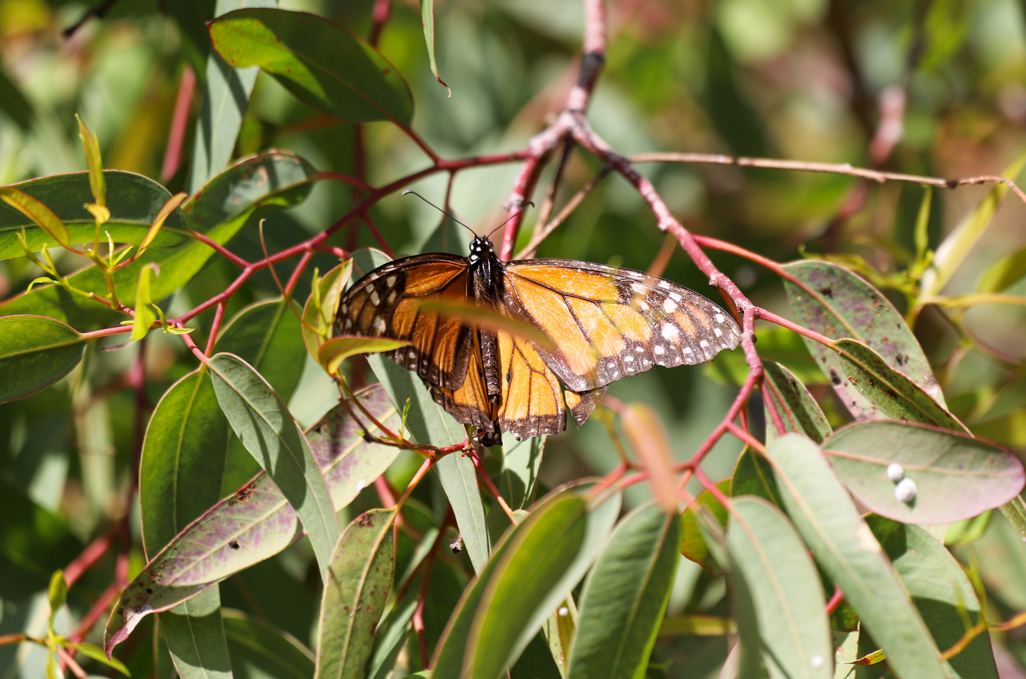
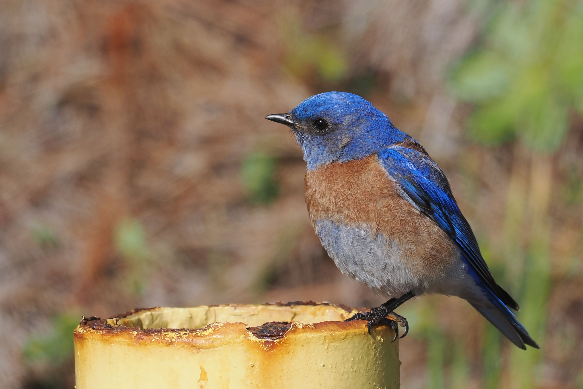
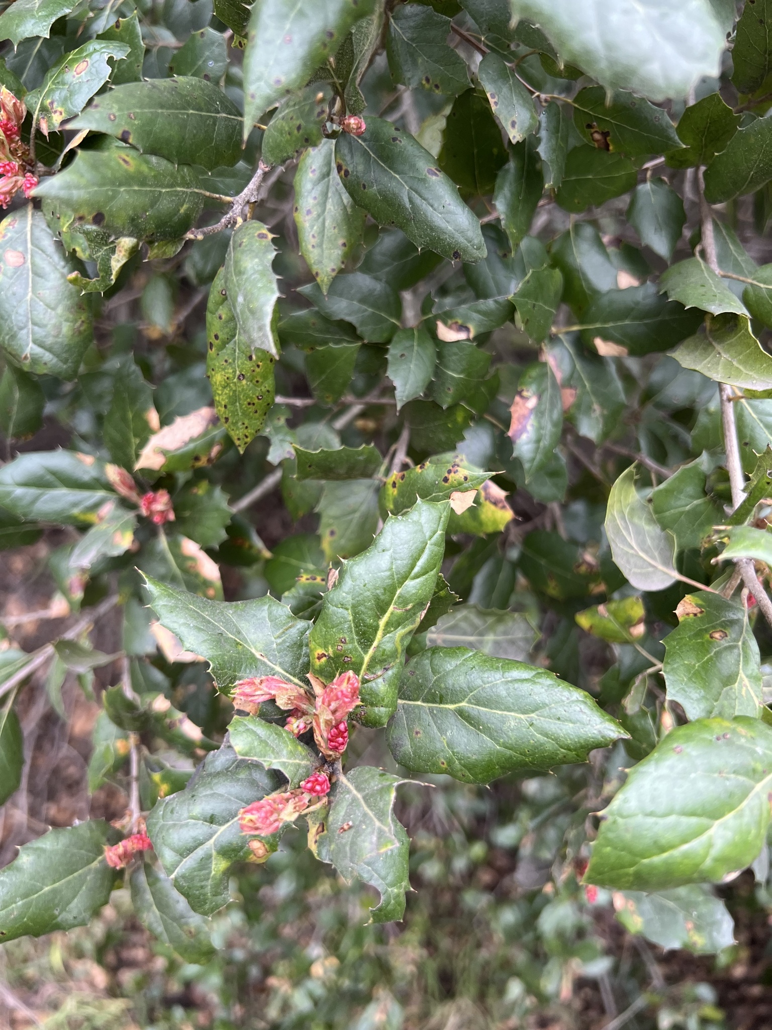
Urban areas are often underestimated in conservation planning, yet our work reinforced that cities can provide essential habitats for native species. Through the project, we identified 19 Conservation Lands Network (CLN) target species, such as the Western Bluebird, wavyleafed soap plant, and Monarch butterfly, that thrive in urban spaces. These findings challenge traditional and outdated notions of cities as “ecological deserts” and emphasize the adaptability of biodiversity to urban environments. Cities act as vital connectors, bridging natural areas and supporting diverse species. Recognizing urban spaces as having value for biodiversity is tied to creating more inclusive conservation strategies. Moving forward, incorporating urban areas into conservation planning is not just an opportunity — it is a necessity.
3. Community Science is a Powerful Tool for Urban Conservation
Community science proved invaluable for gathering data in fragmented urban habitats where scientists and biologists often lack access, such as backyards, schoolyards, and small green spaces. Traditional conservation practices remain focused on natural, rural areas, but urban landscapes are vital to understanding and supporting biodiversity. By embracing and promoting community science, we can generate critical data while engaging residents directly in conservation efforts. This project demonstrated that empowering communities to observe and contribute to biodiversity research builds deeper connections to local nature and fills critical gaps in conservation knowledge.
4. Species Distribution Modeling Can Guide Urban Biodiversity Efforts
Our species distribution modeling revealed key environmental factors that support urban biodiversity, including proximity to substantial green spaces, access to water, and urban tree canopy density. These findings offer a roadmap for urban planners and conservationists, providing clear pathways for enhancing biodiversity in cities. However, we also learned that our species selection relied heavily on the availability of existing data for CLN target species. In future projects, a model-driven approach incorporating expert input earlier in the process could improve species selection and expand the scope of the analysis. By combining data-driven approaches with expert knowledge, we can achieve more comprehensive and impactful conservation outcomes.
5. Cities are Complex Landscapes — Engage Municipalities Deliberately
Navigating conservation in cities presents unique challenges due to the patchwork of public and private lands, overlapping management responsibilities, and governmental complexities. Unlike in more rural
settings, there is no single department — or even a consistent structure across cities—that intersects with urban biodiversity. In one city, the logical partner might be the public health department, while in another, it could be public works or parks and recreation. Local partners are invaluable for navigating these complexities, as they possess a deeper understanding of relationships, rules, and local systems. A key lesson learned is that regional conservation goals must be adapted to fit local urban contexts if they are going to gain traction, and municipalities should be brought into the process early as essential partners. Future efforts must address the complexities of urban landscapes with humility and a willingness to learn, ensuring that conservation strategies are practical, inclusive, and reflective of local needs.
Bay Area Urban Species Search
Connecting Urban Biodiversity to Conservation Planning
March 17–31, 2023
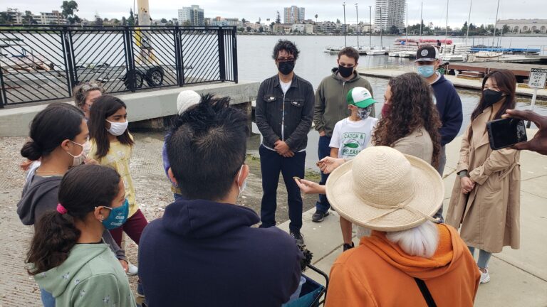
TOGETHER Bay Area and the California Academy of Sciences are joining forces to bring urban biodiversity data into the Conservation Lands Network––and we need your help!
From March 17–31, look for and document these 24 species throughout the places in the greater Bay Area where people live and work: cities, towns, suburbs, neighborhoods, backyards, schoolyards! Sharing your iNaturalist observations will help us better understand how these species are using and benefiting from the urban environment and will allow us to highlight how the urban San Francisco Bay Area contributes to regional conservation.
Thank you to everyone who participated in or promoted the Bay Area Urban Species Search! All together we made over 2200 observations and found all 24 species & species groups we were hoping to find! Here are some highlights:
- About half of the observations made were within the urban boundary in the Bay Area (the gray area here in the Conservation Lands Network Explorer Tool), which is fantastic!
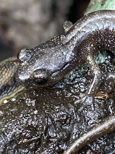
- Our most-observed species overall was the California Slender Salamander, and within the urban boundary, our most-observed species was the Anna’s Hummingbird
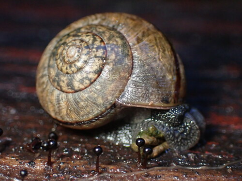
- We’ve increased observations of the Nicklin’s Shoulderband Snail in the Bay Area urban boundary by 50%!
So what’s next? We know that there are important connections across urbanized/urbanizing areas in the Bay Area, helping species move between the Baylands and Uplands and from mountain range to mountain range, and that some species rely on remnant patches of natural habitat within developed areas. We’re using iNaturalist data, like those collected during the Bay Area Urban Species Search, to build distribution models for these 24 species and species groups across the Bay Area to understand how they’re using and benefiting from the urban environment, and where else in the Bay Area they’re likely to be found. This will help position our region to strategically incorporate urban habitat values with the plan to fully incorporate urban areas into the Conservation Lands Network as part of the next version.
Read more about our results here, view observations here, tell us about a Bay Area Urban Species search event you hosted here, and stay tuned for more information in the fall!
Get Involved
Organizations
Is your organization interested in hosting a bioblitz event or spreading the word? Do you already have an event or outing between March 17–31 that could naturally include people making some iNaturalist observations? Great!
We’ve created a toolkit of all the information you’ll need to get your organization involved. Our toolkit includes:
- A list of important native species we want to learn more about (and why)
- Instructions on how to use iNaturalist
- Marketing materials
Individuals
From March 17–31, grab your phone and head outside!
Who: You! Yes, you! All it takes is a phone and the iNaturalist app!
What: The 24 species listed on this grid. Download the grid or view them in iNaturalist and see how many you can find!
Where: Urban areas in the 10 Bay Area counties. Not sure where to look? Check out the gray areas on this map to see the places we most hope to fill in with observations. We have a lot of data from public parks, so we recommend looking around less frequented grounds. Think: school yards & small creeks & city streets.
How: Download iNaturalist and log your observations. New to iNaturalist? View instructions for joining our campaign here.
Questions? Contact us at [email protected].
What’s the story behind this project?
The idea for this project was born at the Conservation Lands Network 2.0 launch event in November 2019. At that event, the CLN project team shared that during the CLN 2.0 update process, the focus teams identified multiple data gaps. A number of the data gaps apply to the region as a whole, including the need for a regional assessment of target species population health. The California Academy of Science’s community science team listened to the presentation in November 2019, and wondered: can community science help fill in gaps in our understanding of species’ use of urban areas? That question started a conversation and eventually led to this project.
Why urban biodiversity?
We are focusing on urban biodiversity for several reasons: 1) the climate crisis has or will impact all species including those living in urban areas; 2) urban areas serve as important habitats for many species; and 3) we can engage more and more diverse people in conservation efforts when it’s happening in their neighborhood and community and when their expertise and experiences are central to the conversation about solutions.
We want to acknowledge that there is exciting and valuable work happening in the Bay Area and in other urban areas to study and conserve urban biodiversity. Programs such as San Francisco Estuary Insitute’s Urban Nature Lab, Trust for Public Land’s Climate-smart Cities, and others. Many TOGETHER Bay Area members are blazing trails in urban conservation and applied urban ecology, and their work offers guidance for this project.
What will this project do?
- Leverage professional and community science by basing the analysis on the priority species and areas identified by the Conservation Lands Network (CLN) led by TOGETHER Bay Area, and data from iNaturalist led by the California Academy of Sciences. While the CLN focuses on rural areas within the Bay Area’s 9 counties and Santa Cruz County, iNaturalist observers and observations tend to be biased towards high population-dense urban areas and publicly accessible lands.
- Connect biodiversity and social equity in conservation planning by facilitating a connection between conservation efforts like the CLN and iNaturalist and community-based organizations in severely disadvantaged communities (SDACs). The project will use the definition of severely disadvantaged communities outlined in Proposition 68: Any community with a median household income less than 60% of the statewide average.
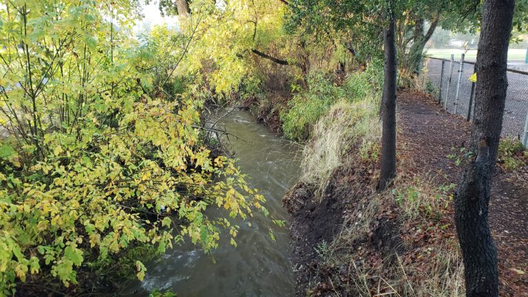
- Integrate a baylands to uplands approach by focusing on urban creeks identified in the CLN 2.0 as priorities.
Over the course of 2022-2023, this project will:
- Identify urban creeks in the Bay Area that are near/in severely disadvantaged communities, are Rank One streams in the CLN, present opportunities for protection and stewardship, show data gaps in the CLN and iNaturalist.
- Convene Bioblitz events in partnership with community-based organizations and land conservation organizations.
- Share the outcomes and outputs from the analysis and Bioblitzes in a report, on the CLN’s website, and via social media.
Want to learn more?
Got 20 minutes? Here’s an FAQ-style project description. Urban biodiversity is a complicated subject and you probably have questions. Hopefully this document will answer many of them.
Got 5 minutes? Here’s a great flash talk about the project by partner Alison Young from Cal Academy. This is part of a larger “Together Tuesday” event held in September 2022 that featured short talks from folks working on urban biodiversity around the Bay Area.
Got 1 minute? Read this abstract:
Connecting Urban Biodiversity brings urban biodiversity data and community-focused actions together to address local needs and inform conservation in the Bay Area. Collaborating with East Bay communities and community-based organizations to collect biodiversity data, specifically in and around urban creeks for a baylands to uplands focus, this project will help address local questions about nature and the human-nature interface. At the same time, we will leverage these data to build species distribution models for a subset of Bay Area plants and animals found on urban to rural gradients and add these to the Conservation Lands Network as a proof of concept for how urban biodiversity and species occurrence data can be integrated into regional planning and conservation.
Sign up!
Are you interested in learning more as the project launches? Do you want to get involved somehow? Sign up to receive updates and invitations:
Questions? Ideas? Contact: Tom Robinson, [email protected]
Funding for this project has been provided by the State Coastal Conservancy.